Registry status
Registration requestedObservé au registreMangrove restoration · CameroonRegistration requested
CAMERR
Inside the VCS 4845 design: a 1,055 ha first activity instance, a 2,000 ha grouped restoration aim, a 40-year carbon forecast and proposed field monitoring. These are filed plans, not verified outcomes.
Registration date
Not listedObservé au registreIssued credits
0 VCUsObservé au registreNamed validator
AENOR CONFIA, S.A. (UNIPERSONAL)Observé au registreA named body is not a completed validation opinion.Mangrove restoration
MéthodologieVM0033 v2.1
Première instance1,055 ha
Horizon du PDD40 ans
VCS 4845


The PDD describes a grouped restoration project. Its 1,055 ha first activity instance, 2,000 ha grouped aim and 40-year filed carbon model are separate from Planète Urgence’s rounded 1,000 ha programme target and reported outputs.
Project proponentDéclaréPlanète Urgence
PDD issueDéclaréVersion 1.0 · 1 April 2025
MethodologyDéclaréVM0033 v2.1
Filed crediting periodConception déposée25 July 2022 to 24 July 2062 · 40 years
The Verra record and public PDD, Planète Urgence programme summary and October 2025 monitoring plan were reviewed. Filed commitments are shown as design claims, not verified outcomes. The 41 annual carbon rows total one tonne less than the stated PDD total. Project gallery images are published on Planète Urgence’s CAMERR page; PDD figures remain at their source.
Jalons
Période
20222030204020502062
VCS crediting period
Owner programme horizon
Période du PDDPériode du registre ou du programme
- Crediting period beginsObservé au registre
The VCS crediting period begins on this date.
- PDD issuedDéclaré
Version 1.0; its crediting period ends 24 July 2062.
Géographie et images
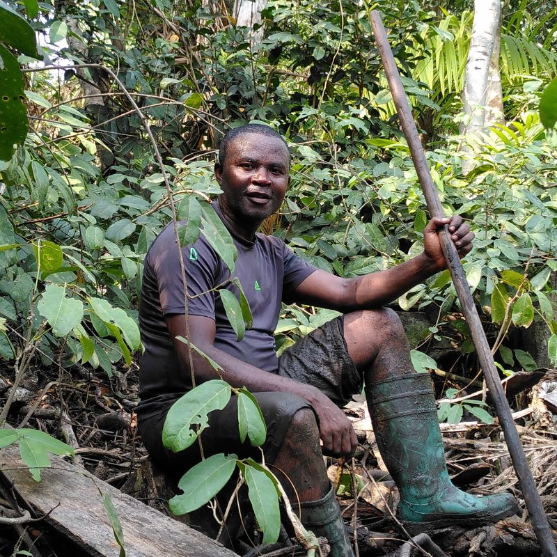
Les limites déposées sont présentées avec des images publiées par les organisations du projet.
FILED SOURCE GEOMETRYCAMERR
Verra source ↗Two filed degraded-area layers in the Wouri estuary. These are proposed project boundaries, not verified restoration.
Use the map controls to zoom · page scrolling does not zoom the map. Geometry is a filed proposal, not an observed restoration outcome.
Map credits and sources
Project boundary: Verra VCS 4845 · VS ID 4845 01.04.2025.kml · Documents > Other, from the Verra public registry.Open the filed source ↗Basemap: OpenStreetMap contributors.Areas calculated geodesically from filed coordinates.
1 / 4
Prévision carbone
Les estimations déposées sont ex ante. Elles ne correspondent ni à des absorptions vérifiées ni à des crédits émis.
Lorsque le registre et le PDD diffèrent, les deux données sources sont affichées et l’écart reste à résoudre.
2062747 tCO₂e annual626,476 tCO₂e cumulative
The 41 calendar-year rows sum to one tonne below the PDD stated total. The filing labels 2062 as a calendar year, while crediting ends 24 July 2062. Annual rows total 626,476 tCO₂e; the PDD states 626,477 tCO₂e. CAMERR PDD · physical pp. 12–13 ↗
Modelled total
626,477 tCO₂e over 40 yearsModèle ex anteModelled annual average
15,662 tCO₂e per yearModèle ex anteNon-permanence risk rating
27%Modèle ex anteRegistry annual estimate
15,662 tCO₂e per yearObservé au registreRestauration et biodiversité
Reported areas have different boundaries and scopes. Bar lengths compare scale only; they do not represent completed restoration.
First activity instance
PDD designOwner programme target
Programme targetGrouped restoration aim
PDD designFILED INTERVENTION DESIGNFrom degraded mangrove to monitored restoration
01Nursery and seedling supply
02Invasive-plant removal
03Mangrove planting
04Assisted natural regeneration
Planting mix specified in the PDD
Rhizophora spp. 80% · Avicennia germinans 20%2,500 stems/ha · 2 × 2 m spacing · CAMERR PDD, physical pp. 14–19MesureBaseValeurÉtat
First VCS activity instance
CAMERR PDD, physical pp. 8, 291,055 ha · Dibombari, Manoka and MouankoConception déposéeGrouped restoration aim
CAMERR PDD, physical pp. 4, 82,000 ha including future instancesConception déposéeOwner programme target
Separate from VCS instance and grouped aim.1,000 ha, roundedObjectifRestoration design
CAMERR PDD, physical pp. 14–19Nurseries, invasive-plant removal, mangrove planting and assisted regenerationConception déposéeNamed species
CAMERR PDD, physical pp. 14–19Rhizophora racemosa, R. mangle and Avicennia germinansConception déposéeTerres et bénéfices communautaires
15accords signés déclarés
17villages et camps nommés
ThèmeCe que dit le dossierÉtat de preuve
Land and use
State-owned mangrove land with local community use rights
DéclaréConsent claim
Ministry authorisation and free, prior and informed consent asserted
DéclaréAgreements claimed
15 signed agreements covering an initial 17 named villages and camps
DéclaréBenefit sharing
Plan described as co-designed, with approval and dissemination promised
DéclaréLe dossier décrit le consentement, les accords et le partage des bénéfices. Leur confirmation indépendante et les montants versés ne sont pas établis.
Validation et suivi
FILED MONITORING DESIGN
Permanent plots, stratified by planting year and degradationMeasure tree diameter, height, biomass and soil carbon; target precision 10% at 90% confidence, with independent remeasurement of 10% of plots.
CAMERR Monitoring Plan · Oct 2025 · physical pp. 3–60.04 haPermanent plot area
10%Target precision
90%Confidence level
10%Plots independently remeasured
Parcelles non établiesOctober 2025 monitoring-plan update
IndicateurConception déposéeÉtat publié
Sampling design
Permanent 0.04 ha plots stratified by planting year and degradation
DéclaréField measures
Tree diameter and height, biomass and soil carbon, with quality checks
DéclaréPlot establishment
Permanent plots not yet established in the October 2025 update
Non publié dans les sources consultéesValidation and verification
No completed validation report or verified removals established; 0 VCUs issued
Non publié dans les sources consultéesObjectifs de développement durable
Contributions inscrites ou déclarées par l’opérateur; aucun impact atteint n’est déduit.
Selected goal01
No poverty
The operator names this goal, but an individual target indicator was not published in the reviewed source.
- Proposed indicator
- Not specified in reviewed filing
- Monitoring record
- Not individually specified
Icons: United Nations Sustainable Development Goals. The content of this publication has not been approved by the United Nations and does not reflect the views of the United Nations or its officials or Member States.
Couverture des preuves
DomaineÉtatLecture
Project boundaryFiled
Two degraded-area layers in the filed KML cover about 1,055 ha; this is not proof of planting.
Carbon forecastFiled estimates
The filed annual rows total 626,476 tCO₂e while the PDD states 626,477 tCO₂e.
Validation and issuanceOpen
No completed validation report or verified removals established; 0 VCUs issued.
Community outcomesDesign claims
The PDD records proponent claims; agreements and consent were not independently checked.
Lacune de preuve
Annual table arithmetic
The 41 annual rows total 626,476 tCO₂e; the PDD states 626,477 tCO₂e.Lacune de preuve ouverteValidation and issuance
No completed validation report or verified removals established; the registry shows 0 VCUs issued.Lacune de preuve ouverteRelation to BluEdea
Boundary overlap with the separate BluEdea project remains unverified.Lacune de preuve ouvertePlanting outcomes
Filed geography and planting plans do not establish independently verified restoration outcomes.Lacune de preuve ouverteImage reuse
Reuse rights for the PDD maps and owner photographs were not established.Lacune de preuve ouverteLimites de lecture
The Verra record and public PDD, Planète Urgence programme summary and October 2025 monitoring plan were reviewed. Filed commitments are shown as design claims, not verified outcomes. The 41 annual carbon rows total one tonne less than the stated PDD total. Project gallery images are published on Planète Urgence’s CAMERR page; PDD figures remain at their source.
Sources et limites de lecture
Verra VCS 4845 record and public PDD ↗
PDD v1.0, issued 1 Apr 2025; physical pages cited above.
Planète Urgence programme summary ↗
Separate programme horizon and rounded target.
Planète Urgence CAMERR monitoring plan ↗
October 2025 update; physical pages cited above.
Planète Urgence CAMERR project page ↗
Programme-level description and context; its figures use a broader scope than the VCS activity instance.
Limites de lecture
The Verra record and public PDD, Planète Urgence programme summary and October 2025 monitoring plan were reviewed. Filed commitments are shown as design claims, not verified outcomes. The 41 annual carbon rows total one tonne less than the stated PDD total. Project gallery images are published on Planète Urgence’s CAMERR page; PDD figures remain at their source.